The map below illustrate our original plan.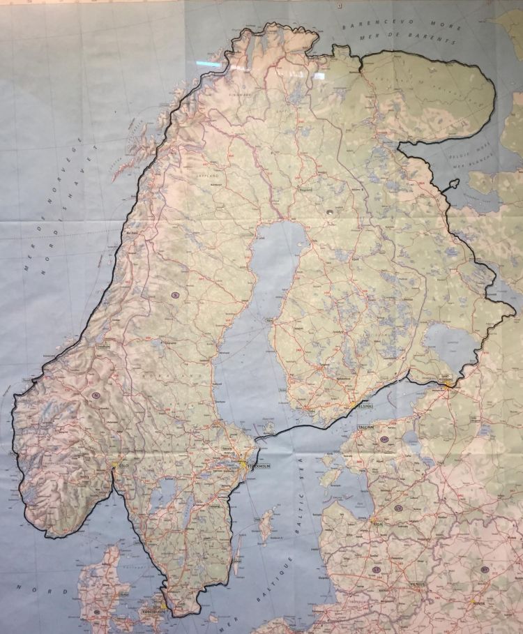
Update 21 February 2018

Since the fall of 2016, we have been in close contact the Russian Authorities at the Embassy in Oslo. As you may know, there are a number of closed military areas along the Kola Peninsula. Initially, we thought we should be able to get a permission to pass these areas. No way, all boats have to be more than 16 nautical miles outside the coast. That will be hard to make in a kayak, we have to go on shore at least ones a day.
 Erling has spent hours and hours mapping out our route through Russia, including all our planned tent sites, and avoiding the closed areas. The map to the left shows our plan to handle the Kola Peninsula. The plan is to use a boat to the Northeastern part of the Kola Peninsula, and the kayak back against Kandlaxe. From here we will drive by car to Norway and Pasvik, the border area, where we will continue back to Oslo.
Overview of the distance and planned time consumption (by November 2016)
| From | To | Distance | 40 km/day | Period, inclusive one resting day/week | 50 km/day | Periode |
| Oslo | Gothenburg | 264 | 6,6 | 1-8 March | ||
| Gothenburg | Stockholm | 1100 | 27,5 | 9 March -8 April | ||
| Stockholm | Helsinki | 420 | 10,5 | 9 – 22 April | ||
| Helsinki | St Petersburg | 410 | 10 | 23 April – 5 May | ||
| St Petersburg | Kandallakse | 1200 | 30 | 6 May – 6 June | ||
| Kandalakse | Jarfjord | 1220 | 31 | 7 June – 12 July | ||
| Jarfjord | Bodø | 1131 | 30 | 13 July – 18 Aug | ||
| Bodø | Langevåg | 750 | 19 | 19 Aug – 10 sep | ||
| Langevåg | Stavanger | 480 | 9,6 | 10-19 Sep | ||
| Stavanger | Oslo | 520 | 10,4 | 20-30 Sep | ||
| Number of days in kayak | 164,6 | 20 | 184,6 | |||
| Reserve days (14%) | 29,4 | |||||
| Total days 1 March – 1 October | 214 | |||||
